Scenery
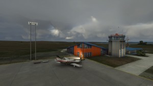
LPBE Beja Civil airfield (Rwy inside Beja MCTR). This freeware scenery was created using pictures taken at the internet, details from APAU (http. roteiro. apau. org zpbeja. html, VFR manual (http. www. nav. pt ais VFRs beja%20ulm. pdf it is supposed you download the file) as well as real measures by Google Earth, this ULM certified airfield at south Alentejo and closer to Beja AB, despite technical information, have, in fact, two paralel rwys in good shape. This scenery is to be used EXCLUSIVELLY with Portugal Terrain from PTSIM (http. www. ptsim. com) For Microsoft FS2004 (ACOF). NOT tested for FSX (you may try, but youll probably get problems with geotagging as well as altitude same fact for all my sceneries and landmarks I publhished so far). By Joao Ferreira.


