Installer
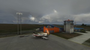
FS2004 Scenery-Johnson County Executive Airport (KOJC) serves Olathe and Johnson County and is owned by Johnson County. The paved runway extends for 4099 feet. The facility is at an elevation of 1096 feet at a distance of about 4 miles from Olathe. Originally constructed as a Naval auxiliary field during World War II, the airport was deeded to the City of Olathe in 1951 and from the city to Johnson County in 1967. Lots of eye candy for the Lago FSE owners. Requires ASDv2. 1, Nova, Nova Gold and NovaSim textures. Traffic tools and AFCAD2 required because of extensive tarmac reworking. By John B. Loney, Jr.


